I understand this now
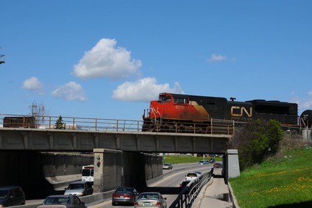
It’s because of a train bridge built in 1949 when there were fewer people living in the south end of the city and traffic patterns were a lot more relaxed. The Canadian National Railway crosses a bridge over Pembina Highway and the resulting underpass has enough room for five lanes of traffic and a pedestrian sidewalk. Back in 1948 this was fine. Shortly after that our love affair with the private automobile really got going and owning a car became common. There was also a lot of development in through the south end of the City so now a well established suburb in Fort Gary wants to drive downtown on Pembina Highway.


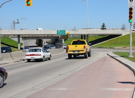
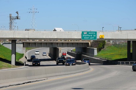
If you’re driving that way from Fort Gary you have three lanes until you hit the underpass. Then you have two and nothing breaks the monotony of a morning commute quite like one lane disappearing. As if that’s not enough it’s the lane on your extreme right that vanishes and then, once you’ve passed the train bridge, it appears again on your extreme left. I’m glad I don’t live in Fort Garry and work downtown.

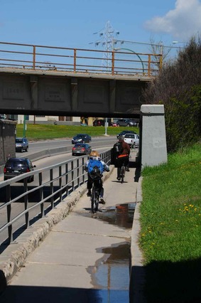
If you’re walking there’s only one sidewalk that takes you under the tracks and it’s quite a job to get there if you’re on the wrong side of the bridge. If you’re riding a bike you can either jockey with the pedestrians or other cyclists on that narrow sidewalk or you can ride with the traffic on the road.

So here’s the City’s problem. To smooth traffic flow we need another northbound lane going under the railway making three lanes in either direction. Since the City is also involved in what they call active transportation, they want to provide space for pedestrians and cyclists too. The City may do this in one of three ways.
Option one:
Remove the sidewalk and use that space for that third lane of traffic. Then they’ll dig tunnels on either side of the road for pedestrians and cyclists. The City can leave the train bridge exactly as it is.
Option two:
The City rebuilds the train bridge so it’s longer and able to cross a wider road with an extra lane of traffic. They’ll build pathways on both sides for those who will walk or ride a bike.
Option three:
The City builds a completely new train bridge a few meters north. This bridge would also be longer and accommodate pedestrians and cyclists on both sides.
Of course, each plan has it’s pluses and minuses all tying into how much it will cost, how much disruption in traffic it will create and what land they’ll need to acquire to build it.
It also underlies a larger problem. Since we can’t read the future and since we can’t see all ends, urban planning becomes one long retrofit.
http://winnipeg.ca/publicworks/MajorProjects/PembinaHighwayUnderpass/default.asp